Sea
Posted: Thu Mar 26, 2020 1:52 am
At the present time, we are not transcribing figures in the State of the Sea column(s).
Philip Brohan, our chief climatologist, has explained that the state of the sea is not necessarily connected with the local weather.
Swells and currents in the ocean can be generated by storms that are literally thousands of miles away.
Wind driven surface waves may travel vast distances.
Mentions of state of the sea in Directions for keeping the ship's log:
Other resources:
H-039-2: Typhoon Cobra — The Worst Natural Disaster in U.S. Navy History

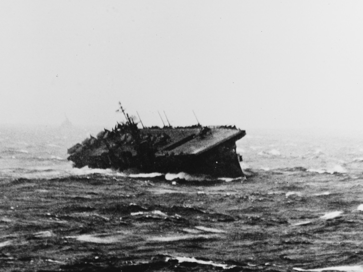
USS Langley (CVL-27) rolling sharply during extreme weather conditions in the Pacific,
likely Typhoon Cobra, 14–19 December 1944
H-039-3: Typhoon Cobra: A Personal Account

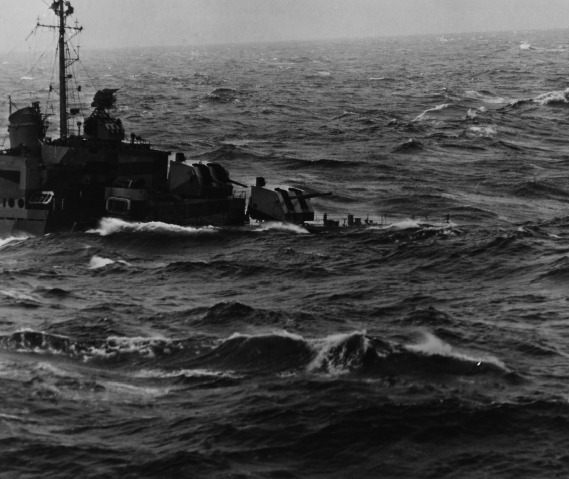
Destroyer during heavy weather in the East China Sea, possibly during Typhoon Cobra in December 1944.
Photographed from USS New Jersey (BB-62) (80-G-470284)

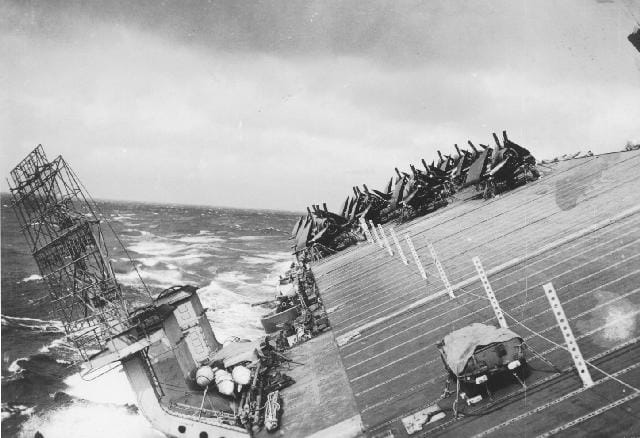
USS Cowpens (CVL-25), "The Mighty Moo," starboard side flight deck facing aft from the island.
Photo was taken around the time Typhoon Cobra hit the Third Fleet on 18 December 1944.
https://laststandonzombieisland.com/201 ... ago-today/
Gordon Smith posted http://www.naval-history.net/IndexVideo ... matsea.wmv
He commented that this helps to understand how even the biggest of ships get damaged and even disappear.
It was sent to him by an ex-RN Commander in Australia.
Philip Brohan, our chief climatologist, has explained that the state of the sea is not necessarily connected with the local weather.
Swells and currents in the ocean can be generated by storms that are literally thousands of miles away.
Wind driven surface waves may travel vast distances.
Mentions of state of the sea in Directions for keeping the ship's log:
- US Navy
- US Revenue Cutter Service and US Coast Guard
- Royal Navy
- Modern Sea Disturbance Scale
Other resources:
- National Oceanic and Atmospheric Administration
- NOAA Central Library
- NOAA Pacific Marine Environmental Laboratory
- National Geospatial-Intelligence Agency, Maritime Guidance (detailed seabed material codes)
- Seabed Symbols for Safer Sailing Navigation, Current
- Chart Legend (PDF)
H-039-2: Typhoon Cobra — The Worst Natural Disaster in U.S. Navy History

USS Langley (CVL-27) rolling sharply during extreme weather conditions in the Pacific,
likely Typhoon Cobra, 14–19 December 1944
H-039-3: Typhoon Cobra: A Personal Account

Destroyer during heavy weather in the East China Sea, possibly during Typhoon Cobra in December 1944.
Photographed from USS New Jersey (BB-62) (80-G-470284)

USS Cowpens (CVL-25), "The Mighty Moo," starboard side flight deck facing aft from the island.
Photo was taken around the time Typhoon Cobra hit the Third Fleet on 18 December 1944.
https://laststandonzombieisland.com/201 ... ago-today/
Gordon Smith posted http://www.naval-history.net/IndexVideo ... matsea.wmv
He commented that this helps to understand how even the biggest of ships get damaged and even disappear.
It was sent to him by an ex-RN Commander in Australia.
