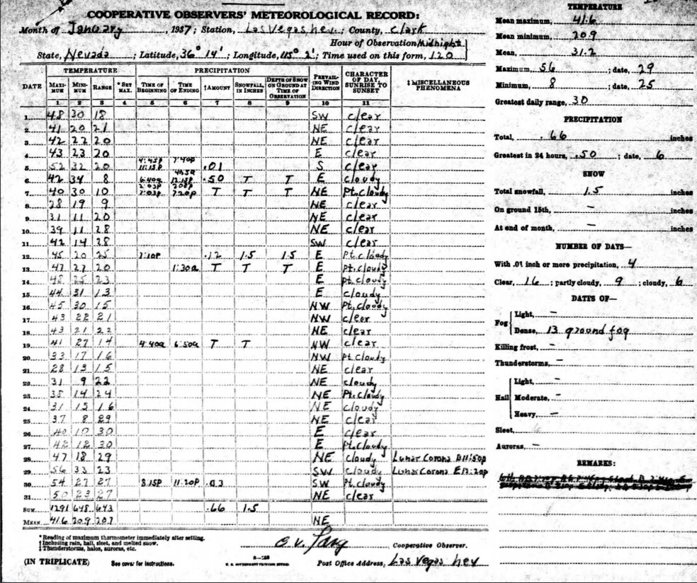
MODIS Image of the day

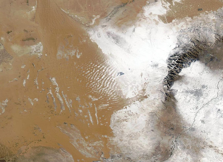
Cloud Streets and Lake Effect Snow near the Great Lakes(1/21/2025 )
In this type of image, snow and ice appear bright electric blue, deep water looks dark blue, vegetation is green, while open land shows in shades of tan. In addition, clouds usually look white, but high, cold clouds carrying ice crystals often are tinted with electric blue.
The widespread, striking cloud formations are known as “cloud streets,” because lines of cloud line up parallel to each other much like lanes on a busy highway. These rows of cumulus cloud form in winter, when extremely cold air moves over unfrozen, relatively warm water. Under these conditions, columns of warm air begin to rise off the lake surface. Once the warm air reaches the frigid air, moisture condenses to form clouds. The rising air then begins to cool and rolls to either side. As the air sinks, clouds dissipate. The rising and sinking motion creates parallel cylinders of rotating air that line up along the direction of the blowing wind.
Frigid air over open water can also trigger another well-known phenomenon seen in winter along the Great Lakes: lake effect snow. This is heavy snow that falls along the southeastern edge of the Great Lakes when icy wind from Canada sweeps across the lakes. The wind carries the relatively warm, moist air from over the lakes and pushes it over land, where the air is cooler. When the moist air encounters cooler temperatures over land, the water condenses into precipitation, creating a dense band of snow that usually does not travel very far inland. A band of lake effect snow is clearly visible along the eastern shore of Lake Michigan, beginning just as the cloud streets end.
https://www.geonames.org/5007990/saginaw-bay.html